Paths & Walks - Background

Many of you wlll be familiar with the walks and trails around Coldingham except those new to the area whether you a resident or visitor.

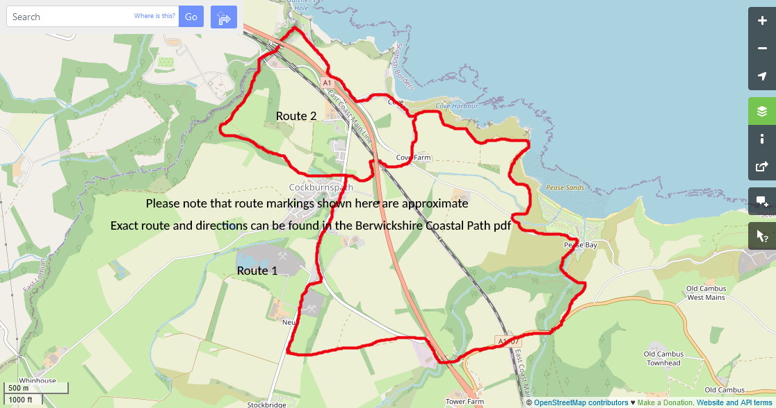
Scottish Borders Council produced a booklet, 48 pages, with 12 Routes throughout East Berwickshire.The routes are primarily for walkers but where possible attempts have been made to accomodate others. In addition to the 12 routes there is also the Berwickshire Coastal Path Map from Cockburnspath to Berwick-Upon-Tweed, all 28.5 miles.

Read the General Safety Advice on page 4 in the booklet. Print off the relevant pages for the route(s) you have selected to take with you. Furthermore, please ensure you clearly understand any additional safety advice given for each route. Remember to follow the Countryside Code and enjoy the walk.

Continue

Routes

As the Routes in the Booklet are all well described with detailed directions, there is nothing more of value that can be added here, it's a really good booklet.

However, below you will find summarised details for each route. The start, finish, distance, walking time and terrain with link to the Booklet's page for each Route. The Walks described in the Walks Around Coldingham booklet are also similarly summarised. Hopefully that may be of some assistance to you in deciding which walk to embark on. If you are on a Mobile select the Image option to view information where it is available.

Booklet (48 pages) - Paths around Eyemouth and Berwickshire Coastal Path (pdf)
Booklet - Walks Around & About Coldingham )pdf)
On a Mobile - View the Berwickshire Coastal Path Booklet as a Series of Images

Continue

Cockburnspath Cove and Pease Bay
Cockburnspath was known as Kolbrand's Path in the 12th Century and is now known locally as Co'path. Steep sided and densely wooded ravines crossed by the Great North Road gave this area considerable military significance. The holder of Cockburnspath Tower was reputed to hold the key to the East March and therefore to the Kingdom of Scotland. It dates back to the 16th Century and is in the design of a typical Borders stronghold - Peel Tower.
Route 1 - Cockburnspath and Pease Circular
Start and Finish : Parking readily available at Cockburnspath, Cove and Pease Bay. Follow the waymarked route in part or in its entirety.
Distance: Cove to Pease Dean return 2 1/2miles or 4.5 km
Walking Time: 1 hour 30 minutes
Terrain: Road and rough grassy paths. Unguarded steep drops between Cove and Pease. Boots recommended for Pease Dean in all seasons but Summer
Read More - Booklet (pdf) - Route 1
On a Mobile - Click here to view as an Image
Route 2 - Cove and Dunglass Circular
Start and Finish: Parking at Cockburnspath or Cove.
Distance: 3 miles/5 km
Walking Time: 1 hour - Toilets and Shop at Cockburnspath
Terrain: Gentle terrain on grassy paths and pavements. Strong shoes or trainers adequate.
Read More - Booklet (pdf) (Route 2)
On a Mobile - Click here to view as an Image
Route 3 - Pease Dean Nature Reserve
Start and Finish: Pease Bay car park.
Distance: 3 miles/5 km
Walking Time: 2 hours - Toilets and shop at Pease and in Cockburnspath
Terrain: Muddy unmade paths, some steep. Boots essential during winter.
Read More - Booklet (pdf) (Route 3)
On a Mobile - Click here to view as an Image
Route 4 - St Helen's Church and Hutton's Unconformity at Siccar Point
Start and Finish: Pease Bay.
Distance: 3 miles/5 km
Walking Time: 2 hours Toilets and Shop facilities in Cockburnspath
Terrain: Uneven grassy path with some steep inclines.
Read More - Booklet (pdf) (Route 4)
On a Mobile - Click here to view as an Image
Coldingham and St Abbs
In the early 700s the first English historian Bede referred to, a place now identified as Kirk Hill on St Abbs Head nature reserve as, Urbs Coludi meaning Colud's fort, the village of the descendents of Colud. Within Colud fort, a royal princess Æbba, sister of King Oswiu of Northumbria, set up a monastery which subsequently burnt down. It is thought that at around this time the religious foundation moved to its present location and took on the name "Coldingham".
Route 5 - Coldingham Priory Walk/Coludi Urbs Walk
Start and Finish: Coldingham Priory.
Distance: 2 miles/3km for full route, various options for a shorter walk.
Walking Time: up to 2 hours Car park, facilities, pub and shop.
Terrain: Steps; boardwalks; stiles and rough trodden path in places.
Read More - Booklet (Route 5)
On a Mobile - Click here to view as an Image
Route 6 - ST Abbs and Coldingham Bay on the Creel Path
Start and Finish: Coldingham Priory..
Distance: 3 1/2 miles St Abbs and Coldingham Bay circular
Walking Time: up to 2 hours plus time to enjoy the sights en route. Car Park, facilities, pub and shop in Coldingham. Cafes and shop in St Abbs. St Vedas Hotel and Beach Cafe at Coldingham Bay
Terrain: Stiles on St Andrews Burn. Creel Path is only passable by foot.
Read More - Booklet (Route 6)
On a Mobile - Click here to view as an Image
Route 7 - The National Trust's St Abbs Head circular walk
Start and Finish: St Abbs village or The National Trust for Scotland's visitor Centre.
Distance: 4 1/2 miles / 7 km
Walking Time: 2 hours Toilets, Car park, visitor centre and cafe in St Abbs or at St Abbs Head visitors centre
Terrain: Steps and rough trodden path, boots recommended.
Read More - Booklet (Route 7)
On a Mobile - Click here to view as an Image
Berwickshire Coastal Path
It may seem hardly necessary to provide directions for the coastal path other than saying - walk north or south keeping the sea on your right or left! Alongside some very interesting facts along the way there are a number of twists and turns through towns and villages which are highlighted in the following guide.
Cockburnspath to St Abbs
Distance: 14 miles / 22 km
Walking Time: 8 hours
Terrain: Steps and rough trodden path, boots recommended.
Read More - Booklet
On a Mobile - Click here to view as an Image
St Abbs to Burnmouth/Eyemouth
Distance: 7miles 11km or or Eyemouth 3 1/2 miles / 6km
Walking Time: 4 or 2 hours
Terrain: Steps and rough trodden path, boots recommended.
Read More - Booklet
On a Mobile - Click here to view as an Image
Eyemouth to Berwick Upon Tweed
Distance: 11 miles / 17km
Walking Time: 5 1/2 hours
Terrain: Steps and rough trodden path, boots recommended.
Read More - Booklet
On a Mobile - Click here to view as an Image
Eyemouth
Eyemouth has been Scotland's largest south-eastern port since 1482 when Berwick upon Tweed was lost to England. In the wars of the mid-16th century Fort Point was fortified twice; by the English in the 1540s and by the French several years later.
Route 8 - Eyemouth Fort, Harbour and Sea Braes
Start and Finish: VisitScotland Information Centre.
Distance: 2 miles / 3km
Walking Time: 1 - 2 hours. Toilets, Harbour and Bantry Car Park. Car Parking throughout town.
Terrain: Steps as indicated, loose stone paths.
Read More - Booklet (Route 8)
On a Mobile - Click here to view as an Image
Route 9 Gunsgreen House and Sea Braes
Start and Finish: Gunsgreen House.
istance: 2 miles / 3km
Walking Time: 1 hour. Toilets - Harbour and Bantry Car Parking at Gunsgreen House.
Terrain: Steps, path rough, unsurfaced and narrow in places.
Read More - Booklet (Route 9)
On a Mobile - Click here to view as an Image
Route 10 Eyemouth and Coldingham circular
Start and Finish: Eyemouth Bantry. St Abbs or Coldingham for a shorter circular.
Distance: 7 miles / 11 km. St Abbs or Coldingham circular 5 miles /7 1/2km
Walking Time: 4 hours. Toilets - Eyemouth Bantry, Coldingham village and Bay, St Abbs Car Parking at Eyemouth Bantry, St Abbs
Terrain: Steps, path rough, unsurfaced and narrow in places.
Read More - Booklet (Route 10)
On a Mobile - Click here to view as an Image
Ayton, Burnmouth and Lamberton
The name Ayton or "Eyetown" is derived from the River Eye which passes through and forms the port in Eyemouth. The red sandstone building of Ayton Castle was built in the Scots baronial style by architect James Graham.
Route 11 -Chester Hill Fort, Burnmouth circular
Start and Finish: Upper Burnmouth, The First and Last Pub.
Distance: 2 1/2 miles / 4km.
Walking Time: 1-2 hours Toilet at the Harbour in Eyemouth at the Bantry Car Park Parking is available on the street, and if a customer, use the Pub car park.
Terrain: Minor roads, grass fields and muddy farm tracks.
Read More - Booklet (Route 11)
On a Mobile - Click here to view as an Image
Route 12 - Ayton and Eyemouth (Eddie's) Trail
Start and Finish: Eyemouth Bantry Car Park.
Distance: 6 1/2miles / 10km.
Walking Time: 5 hours. Toilet in Eyemouth at the Bantry Car Park
Read More - Booklet (Route 12)
On a Mobile - Click here to view as an Image
Walks Around and About Coldingham
We hope you will enjoy these walks but ask that dogs are kept on loads at all times. Litter, including bagged dog litter should be deposited in the litter bins you will come across.
Walk 1 - Coldingham Heritage Trail
Start and Finish : Coldingham Village Car Park
Distance: approx 2 miles circular
Terrain: Minor Roads, unmade track and paths.
Toilets: Coldingham Village Car Park
Read More - Booklet (Walk 1)
Walk 2 - Cockit Hat Circular Walk
Start and Finish: Coldingham Village Car Park
Distance: approx 2 miles
Terrain: Minor Roads, unmade track and paths.
Toilets: Coldingham Village Car Park
Read More - Booklet (Walk 2)
Walk 3 - Templehall Circular
Start and Finish: Coldingham Village Car Park.
Distance: approx 3 miles - 5 km
Terrain: Main Road and Narrow Road.
Toilets: Coldingham Village Car Park
Read More - Booklet (Walk 3)
Walk 4 - The Hill Path Circular
Start and Finish: Coldingham Village Car Park.
Distance: approx 2 miles
Terrain: Main and minor roads and paths.
Toilets: Coldingham Village Car Park
Read More - Booklet (Walk 4)
Walk 5 - The Milldown Circular
Start and Finish: Coldingham Village Car Park.
Distance: approx 3 miles
Terrain: Main and minor roads and grassy paths.
Toilets: Coldingham Village Car Park and Coldingham Bay
Read More - Booklet (Walk 5)
Walk 6 - The Creel Path Circular
Start and Finish: Coldingham Village Car Park.
Distance: approx 4 miles
Terrain: Main road, sands and paths.
Toilets: Coldingham Village Car Park, Coldingham Sands and St Abbs Harbour
Read More - Booklet (Walk 6)
Walk 7 - Coldingham Moors Circular
Start and Finish: Coldingham Village Car Park.
Distance: approx 6 miles
Terrain: Main and minor roads without pavements.
Toilets: Coldingham Village Car Park
Read More - Booklet (Walk 7)
Walk 8 - THree Burns Circular
Start and Finish: Coldingham Village Car Park.
Distance: 3 - 4 miles
Terrain: Main, minor roads and cross country paths.
Toilets: Coldingham Village Car Park
Read More - Booklet (Walk 8)
Walk 9 - Tun Law Circular
IMPORTANT: Walk NOT open April or May. Dogs MUST be kept on leads. LITTER MUST NOT be dropped. ADHERE to the directional arrows.
Start and Finish: Coldingham Village Car Park.
Distance: approx 5 miles
Terrain: Minor roads and grazing clifftop pastures
Toilets: Coldingham Village Car Park
Read More - Booklet (Walk 9)
Walk 10 Coldingham to the Alewater Circulat Walk
Start and Finish: Coldingham Village Car Park.
Distance: 4 miles
Terrain: Roads and grassy footpaths. Strong FOOTWARE recommended.
Toilets: Coldingham Village Car Park
Read More - Booklet (Walk 10)
Walk 11 Coldingham to Eyemouth via Alemill
Start and Finish: Coldingham Village Car Park to Eyemouth Coop.
Distance: 4 miles
Terrain: Minor tarred single track roads.
Toilets: Coldingham Village Car Park and Eyemouth Coop Car Park
Read More - Booklet (Walk 11)
Walk 12 The coastal path from Eyemouth to Coldingham
Start and Finish: Coldingham Village Car Park.
Distance: 4 miles
Terrain: Tracks and Paths
Toilets: Coldingham Village Car Park and Eyemouth Coop Car Park
Read More - Booklet (Walk 12)
Walk 13 ST Abbs Head Circular
Start and Finish: Northfield Car Park
Distance: 4 miles
Terrain: Minor roads, rough tracks and coastal paths
Toilets: Northfield
Read More - Booklet (Walk 13)
×
  • Booklets (Click appropriate Booklet link to Open)
  • Remember : Take water, food, appropriate clothing and shoes !!
  • Paths - Berwickshire Coastal Path - Coldingham and Eyemouth Booklet (pdf)
  • Walks - Walks Around and About Coldingham Booklet (pdf)
  • On a Mobile - View the Beriwckshire Coastal Path Booklet as a Series of Images